Escaped Doodles
July 25, 2023 - Montana & Wyoming (mostly)
We made it to the Bighorn Mountains for the Fourth of July. We've been to the Bighorn Mt several times and like the area. This time we took the southern route (Hwy 16) and stayed about a week at Lake View CG about 10 days. It looks like it was a heavy winter and we know it was a wet spring. The lakes are full and the rivers are flowing. That does bring out the wildflowers.
 |
 |
It was a quiet Fourth of July being in the National Forest. Nice stay but quite wet.
Then through Cody to Parkside CG south west of Red Lodge. Very nice campground at the base of Beartooth Pass. This is on Hwy 212 which goes over Beartooth Pass and on to Yellowstone NP, but not the fastest way to the park. We spent a week here just relaxing and walking.
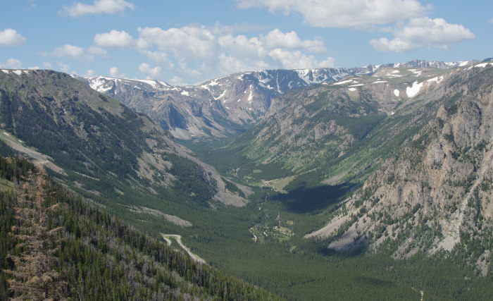
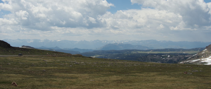
Hugh has wanted to drive over Beartooth Pass for some years. There is a route that goes over Beartooth Pass, turns onto Hwy 296, and meets Hwy 120 north of Cody. From there it's easy to make a loop going north to Belfry and back to Parkside. We tried to do this loop but forgot that Parkside itself is at 8000' and Beartooth is nearly 11,000'. The elevation at Parkside likely stretched Denise's capacity as she started having trouble on just the fist set of Beartooth switchbacks, so the trip was abandoned. Hugh did the loop by himself another day. The fist picture below shows the scene looking back, one switchback can be seen below. The valley seen is where Parkside is located.
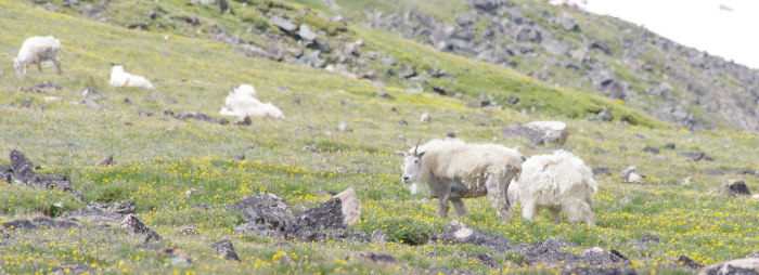
After the first major climb the road levels off somewhat in alpine terrain. The pic below is of a herd of mountain goats grazing alongside the highway.
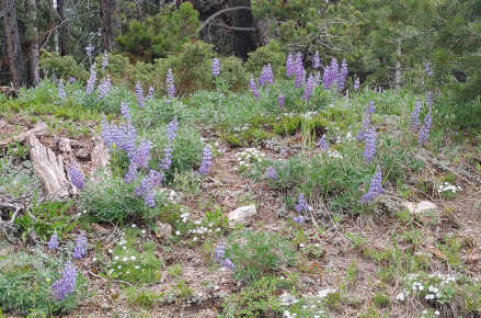
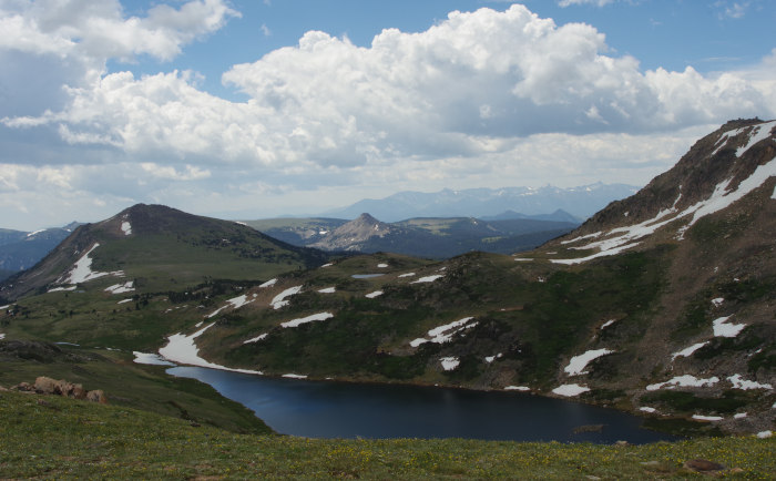
On "top" where it "levels out" there are several small rocky alpine lakes. Very pretty area.
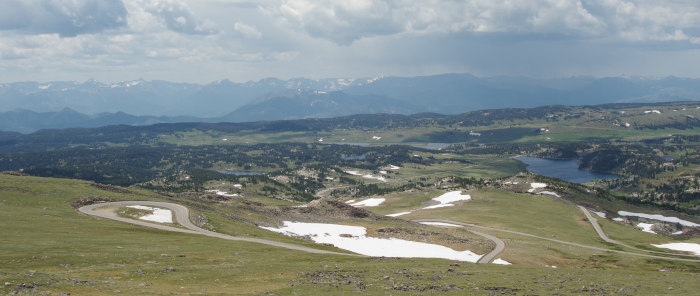
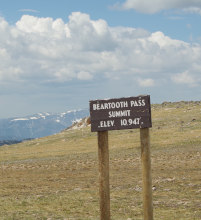
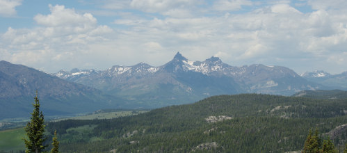
Just a pic to prove the summit was attained. Also a pic of the mountains to the west towards Yellowstone.
 |
 |
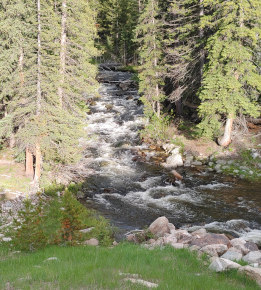
Hwy 296 takes off from the Beartooth Highway and heads back towards Cody. Very nice drive but not as spectacular as the Beartooth Hwy. 296 follows along the Clarks Fork of the Yellowstone River for about half of this section. The pic below shows the Clarks Fork canyon.
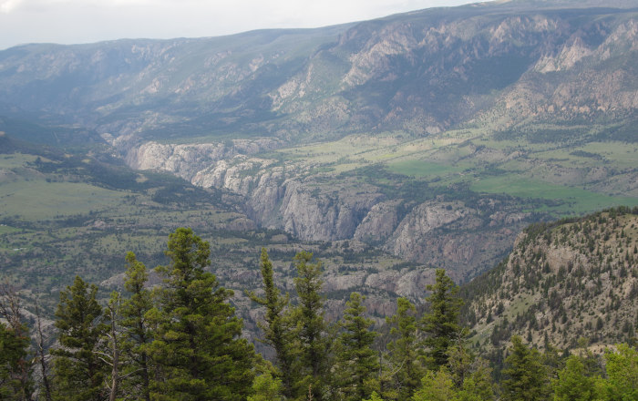
This section of the Clarks Fork is a "wild and scenic" river so no roads following the river through the canyon. The highway leaves the river and climbs over Dead Indian Hill summit at 8000'. It was a great drive and it was sad Denise couldn't make the trek.
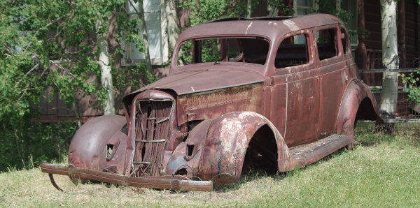
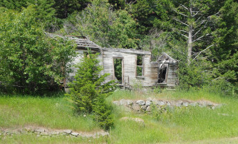
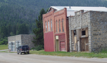
Next stop was Jo Bonner CG at Canyon Ferry Reservoir near Helena. It looked good on paper but not very good in real life. Not bad but not very inviting nor pleasant. A small CG surrounded by low density residential housing, so no place to go walking. This really pointed out the problems with making reservations ahead. We'd paid for six nights so we stayed, but if we hadn't had reservations we'd have been out in one night. There are a good number of ghost towns in the area, mostly mining. We tracked down a few which were interesting, but other times found the site but no signs of a town.
 |
 |
We drove out through Red Lodge which looked like a nice touristy town. Turned east through Misoula spending one night at Yellow Rock CG and over LoLo Pass (Hwy 12) in Idaho. Some miles past the summit we set up camp at Powell CG. Darn nice Forest Service CG. We signed up for four nights but, alas, we left a day early.
More to come, but that'll be the next journal instalment.
Safe Travels